![]()
Introduction
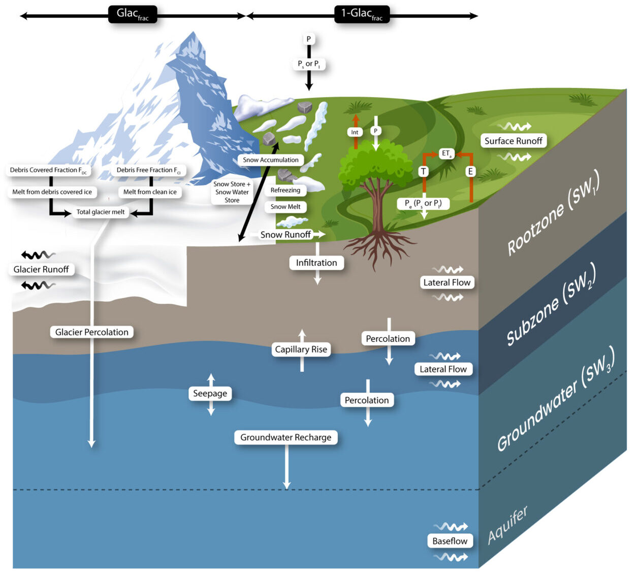
SPHY (Spatial Processes in Hydrology) is a conceptual, spatially distributed (raster-based) “leaky-bucket” type water balance model. It integrates dominant hydrological processes, including:
- Rainfall–runoff
- Lake/reservoir outflow
- Cryospheric processes (snow, ice, glaciers)
- Evapotranspiration
- Soil hydrological processes
SPHY has evolved over time by incorporating the best components from well-established simulation models, such as SRM, VIC, HydroS, SWAT, PCR-GLOBWB, SWAP, and HimSim. It captures relevant terrestrial hydrological processes across various spatial scales (local, regional, and global) and is adaptable to different land-use changes, extreme weather conditions, and climate scenarios.
An overview of the SPHY model concepts is illustrated in the figure below:
Key Features
Mass conservation is the core principle of the SPHY model. The dominant hydrological processes are defined by physical equations and parameters. The model employs a sub-grid variability approach to accurately represent fine-scale processes. Each model cell can be:
- Glacier-free
- Partially glacierized
- Completely covered by glaciers
Non-glacierized cells can include different land-use types. Sub-grid variability is primarily influenced by fractional vegetation coverage, impacting processes such as interception, effective precipitation, and potential evapotranspiration.
The model divides the soil/land column into:
- Two upper soil stores
- A third groundwater store
Each store has corresponding drainage components: surface runoff, lateral flow, and base flow. Glacier melt contributes to river discharge via two pathways:
- Slow component: Percolation into the groundwater reservoir, eventually becoming base flow.
- Fast component: Direct runoff.
Model Capabilities
SPHY simulates the dynamic behavior of glaciers by integrating key processes such as accumulation, ablation, and ice mass transfer from accumulation to ablation zones. If a glacier loses mass, ice from the ablation zone is redistributed according to volume ice redistribution principles.
Additional modules include:
- Lake module: Tracks lake levels and storage over time, using an advanced routing scheme to direct water flow from lakes to downstream regions.
- Erosion module: Calculates soil erosion due to raindrop impact, overland flow, and river flow.
There is no single best hydrological model for all applications; the optimal choice depends on project goals. However, SPHY stands out due to its versatility and wide range of functionalities, including:
- Spatial scale: SPHY can be applied at various spatial scales, from small farms to large regional and global applications. Users can analyze hydrological variability across different resolutions (e.g., 50m for glaciers, 1000m for general hydrology).
- Temporal scale: The model supports sub-daily to yearly time steps, allowing flexibility based on data availability and process dynamics.
- Adaptability: SPHY can be customized for different climatic conditions. Users can deactivate non-relevant processes (e.g., glacier melt in tropical regions) to streamline simulations.
- Data requirements: SPHY can operate with minimal data or integrate extensive datasets, such as hydrological measurements, cryospheric data, crop coefficients, and lake/reservoir information.
- User-friendliness: Designed for accessibility, SPHY allows input via static values, time series, or spatial raster data. Outputs include detailed spatial maps and time-series data tailored to user preferences.
FutureWater Applications
FutureWater utilizes SPHY for a variety of hydrological studies and applications:
- Hydrological change analysis: Assessing past and future hydrological regimes in projects such as IWRM-Bhagirathi and IWRM-Tajikistan.
- Basin management: Supporting strategic planning for major river basins, such as the Ganga River Basin.
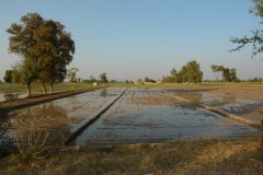
- Irrigation management: Providing farm-specific irrigation advice, such as in Romania and Angola.
- Flow forecasting: Used in operational flow prediction in Chile.
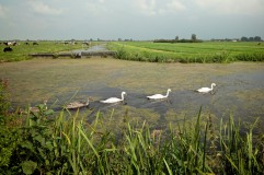
- Land degradation and restoration: Applied in landscape management projects such as Madagascar.
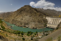
- Hydropower assessments: Supporting hydropower development in Georgia, Indonesia, Kenya, and other locations.
- Flood risk assessment: Evaluating extreme weather impacts in projects such as SYSTEM-RISK and IMPREX.
More Information
For further details, visit sphymodel.com.
Related projects
-

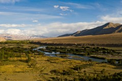
MountAInWater: Global Reanalysis of Mountain Water Resources and Future Tipping Points
Mountains supply freshwater to billions of people, yet our understanding of how glaciers, snowpacks and permafrost are responding to climate change remains incomplete, particularly at the global scale. Critical tipping points in the cryosphere could fundamentally alter water availability downstream, with far-reaching consequences for agriculture, energy and ecosystems. To increase...
-
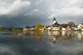
Climate Risk Assessment and Prioritisation of Existing and Planned Reservoirs in Armenia
For the Asian Development Bank, FutureWater assesses how climate change will affect Armenia's existing and planned reservoirs across the country's six primary river basins. Using the SPHY hydrological model with ERA5 and NASA-NEX climate projections, the assessment examines water availability, seasonality, and the shift to earlier snowmelt that reduces late-summer...
-

3POLE4FOOD: Upstream-Downstream Linkages in Major Asian River Basins
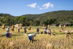
Mountain water resources are essential for food production across Asia. Many major river basins originating in High Mountain Asia support large irrigated agricultural areas downstream, where millions of people depend on reliable water availability for crop production, livelihoods and food security. Climate change is expected to alter snow and glacier...
-
SPHY QGIS Plugin for Hydrological Modeling
SPHY (Spatial Processes in Hydrology) is a conceptual, spatially distributed (raster-based) “leaky-bucket” type water balance model. Developed by FutureWater, with the support of national and international partners, SPHY has emerged as a robust, user-friendly tool for undertaking operational and strategic water resource management decisions. It stands out for its physical...
-
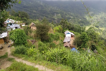
RoSPro: Roadside Spring Protection to Improve Water Security in Nepal
The mid and high-altitude areas of the Himalayas face a critical water scarcity issue, making them one of the most vulnerable regions in the world. Springs are essential lifelines for millions of mountain communities, serving as the primary source of domestic water and local food security. Unfortunately, the flow regimes...
-

Integrated Water Resources Management in Tajikistan
Given the abundant freshwater resources in Tajikistan, water plays a crucial role in the country's socioeconomic development. However, the rising population, economic growth, and the growing impacts of climate change pose significant challenges to ensure water availability and accessibility. This project aims to address the aforementioned information gap by improving...
-
WE-ACT: Water Efficient Allocation in a Central Asian Transboundary River Basin
The WE-ACT project’s overall goal is to demonstrate a Decision Support System (DSS) for water allocation in a Central Asian transboundary river to increase shared benefits and foster the adaptation of water resources management and planning to climate change.
-
SOS-Water: Water Resources System Safe Operating Space in a Changing Climate and Society
The SOS-Water Project endeavours to set out the boundaries within which the Earth’s capacity to provide life-support systems for humanity is not endangered, and humanity’s capacity to adapt to environmental changes is not overburdened. Crossing such thresholds or tipping points in the complex Earth system could result in abrupt and...
-

Development of a Glacio-Hydrological Model and IWRM Plan for the Uttarakhand subbasin in India
The Swiss Agency for Development and Cooperation’s (SDCs) Global Programme Climate Change and Environment (GP CCE) India is supporting the operationalization of climate change adaptation actions in the mountain states of Uttarakhand, Sikkim and Himachal Pradesh through the phase two of the “Strengthening State Strategies for Climate Action” (3SCA) project...
-
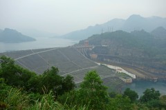
Hydrological Assessment for Hydropower in the Lukhra River
The objective was to develop a hydrological assessment for a planned run-of-river hydropower plant in the Lukhra river basin in Georgia. There is no observed river discharge data available. Hence, the assessment was developed based on hydrological simulations of the basin using the SPHY model (Terink et al., 2015) and...
-

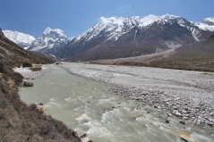
Glacio-hydrological Assessment for Hydropower in the Nakhra River
The objective was to develop a glacio-hydrological assessment for planned run-of-river hydropower plant locations in the Nakhraa river basin in Georgia. The availability of observed river flow data is limited. Hence the assessment was developed based on hydrological simulations of the basin using the SPHY model (Terink et al., 2015)....
-

Training on Using Open Source Platforms for Hydrological Modelling of Data Sparse Regions in Nepal
This training was attended by sixteen researchers (seven female and nine male) from IOF, Department of Hydrology and Meteorology (DHM), Central Department of Hydrology and Meteorology (CDHM), Department of Forests and Soil Conservation and the Institute of Engineering (IOE). The overall objective of this training was to ensure the use...
-
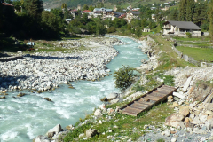
Glacio-hydrological assessment for hydropower, Mestiachala river, Georgia
The objective of this project was to develop a hydrological assessment for two potential hydropower plant locations in the Mestiachala basin in Georgia. The availability of observed river discharge data is limited. Hence the assessment was developed based on hydrological simulations of the basin using the SPHY model (Terink et...
-
Improved catchment management for small hydropower
This study assessed the impacts of various investment portfolios for catchment management activities on the cost-benefits of small hydropower schemes, in two case study catchments in Kenya and Tanzania, and analyzes the return-on-investment for the hydropower developers. Catchment degradation trends, climate change impacts and socio-economic changes increasing competing water use...
-

Pan-TPE: Changes in the Pan-Third Pole Water Tower
The proposed research targets changes in climate, water supply and demand, and suitable adaptation measures for green development of the Silk Road Economic Belt (SREB) in the river basins crossed by the SREB transect. Given the strong role of large scale hydrology in the proposed research activities, the spatial domain...
-

Building Climate Change Resilience in Asia’s Critical Infrastructure
Critical infrastructure in South Asia and Southeast Asia needs to become more resilient to climate change. A Technical Assistance project, supported by Asian Development Bank (ADB), looks at three key sectors: transportation, transport and water. FutureWater is responsible for the assessment of the water sector which will aim to increase...
-

LAUREL: Land Use Planning for Enhanced Resilience of Landscapes
Deforestation, population growth, and climate change are only some of the challenges to sustainable landscape management in Madagascar. Severe impacts of land degradation on crop production, water availability and biodiversity are already observed and expected to exacerbate in the future. To address these challenges, the World Bank is supporting the...
-
Training in Water Resources Modelling for ARA-Sul
A Tailor-Made Training on Water Resources Modelling was required to equip the staff of the water agencies in Mozambique (ARAs) with additional knowledge to have a stronger advisory role towards policy and decision makers, and people living in the area. FutureWater provided this training to ARA-Sul and ARA-Norte. This training...
-
Hydropower Development Assessment for the Tamakoshi River Basin
The overall objective of this project is to improve the understanding of the expected impacts of climate change on water availability in the context of potential hydropower development in the Tamakoshi River Basin. Specifically, the project aims to (i) Understand the current baseline hydrological regime of the Tamakoshi River Basin,...
-
System-Risk: A large-scale systems approach to flood risk assessment and management
System-Risk is a Marie-Skłodowska-Curie European Training Network which aims on developing and implementing a systems approach for large-scale flood risk assessment and management and provides a framework for training and career development of 15 Early Stage Researchers (ESRs). In collaboration with the Royal Meteorological Institute (KNMI), FutureWater is the hosting...
-

Training in Water Resources and Allocation Models
A Tailor-Made Training was provided to three ARAs in Mozambique, being ARA-Centro (Beira), ARA-Centro-Norte (Nampula), and ARA-Norte (Pemba). The provided Tailor-Made Training focused on learning to work with a Water Resources and Water Allocation Model, and apply them to a catchment in Mozambique. Emphasis was put on how these tools...
-
Strategic Basin Planning Ganga River Basin
The World Bank has assigned Deltares and its partners AECOM India and FutureWater to carry out the project ”Analytical Work and Technical Assistance to support Strategic Basin Planning for Ganga River Basin in India”. The key objectives of this project are (i) Significantly strengthen the capability of relevant central and...
-
Inclusive Development Paths for Healthy Red River Landscapes
Rapid land use changes in the Red River Basin threaten water resources. This project will be working in the Day River Catchment, a Red River distributary important for Hanoi, where most of these problems are manifest. The project will develop equitable and economically viable pathways for the land and water...
-
Demonstration of Remote Sensing Information for Integrated Reservoir Management in the Red River Basin in Northern Vietnam
In 2011 the Vietnamese and Dutch government signed a Memorandum of Understanding on the establishment of a Government to Government (G2G) program for improved integrated planning and monitoring of water resources for transboundary water management and disaster risk management. This project was formulated as part of the G2G trajectory towards...
-
SWIMM: Soil Water evaluation system based on Integrated Measurements and Modelling
The main objective of the project was to support policy making, under current and future climate conditions, on optimal water management in nature reserve areas, based on uniform and consistent data collection. The project built upon knowledge developed under the “Klimaat voor Ruimte” framework and refined and demonstrated a method,...
-

HI-AWARE: Himalayan Adaptation, Water and Resilience
HI-AWARE aims to contribute to enhanced adaptive capacities and climate resilience of the poor and vulnerable women, men, and children living in the mountains and flood plains of the Indus, Ganges, and Brahmaputra river basins. Research, including modeling, scoping studies, action research, and randomized control trials, is conducted at 12...
-
Central Asia Regional Risk Assessment for Water Related Energy Sector Impacts
The objective of this study was to support the “Central Asia Regional Energy Sector Vulnerability Study” led by Industrial Economics (IEc) and funded by the World Bank, by carrying out an expanded risk assessment for water availability and water related energy sector impacts in Central Asia. The work built on...
-
Gridded Meteorological Datasets and Hydrological Modelling in the Upper Indus Basin
Understanding of the hydrological regimes in the mountainous Upper Indus basin (UIB) is essential for water resources management in the region. High-resolution gridded meteorological datasets, which capture the spatial variability of precipitation, are critical for modelling the hydrology of high-mountain regions. Improvements to existing gridded datasets using high-elevation station data...
-
INTOGENER: Integration of EO data and GNSS-R signals for ENERgy applications
The need for accurate short and mid-term forecasting of the water flow generated from snowmelt in mountain basins is an important component for water management and hydropower activities. Due to the remoteness and difficult access to basins especially in cold weather conditions, where in-situ snow measurements, water level monitoring and...
-
Water Availability Analysis for the Upper Indus, Ganges and Brahmaputra River Basins
As part of the Himalayan Climate Change Adaptation Program (HICAP) ICIMOD has contracted FutureWater to generate climate change and water availability scenarios for the upstream parts of the Indus, Ganges and Brahmaputra river basins based on a high resolution hydrological model that FutureWater has developed.
-
Water and Adaptation Interventions in Central and West Asia
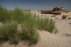
To assess the water resources availability in the Central Asia region under climate change hydrological models were developed for the two major rivers in the region, the Amu Darya and Syr Darya. Capacity building activities were undertaken to develop the capacity in each of the participating countries to use the...
-
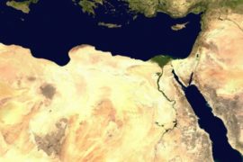
The Middle East and North Africa Regional Water Outlook
The Middle East and North Africa (MENA) region is considered the most water-scarce region of the world. Water resources investments absorb large amounts of public funds, which could often be used more efficiently. The need to understand the potential for improved water resources investments is therefore urgently needed. But a...
-

Q Fever and Physical Environmental Factors
There are strong indications that the risk of infection in humans with Q fever depends on physical environmental factors such as warm weather with dry soils and a certain wind. In this study, the influence of these factors, soil type and, in particular, usage and humidity are examined, taking into...
-
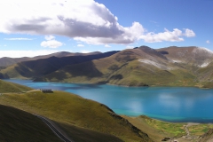
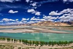
CEOP-AEGIS: Hydrology and meteorology of the Tibetan Plateau
This project delivered a prototype Water Balance Monitoring System (WBMS) and a three-year data set including observations of the water balance terms of the Tibetan Plateau on weekly and monthly basis. These observations contributed to clarifying the role of Plateau hydrology in the onset and intensity of the Asian Monsoon...