WATER · ROADS · COMMUNITIESA story from the Himalayan mid-hills
01 / THE APPROACH
Turning Challenges into Opportunities
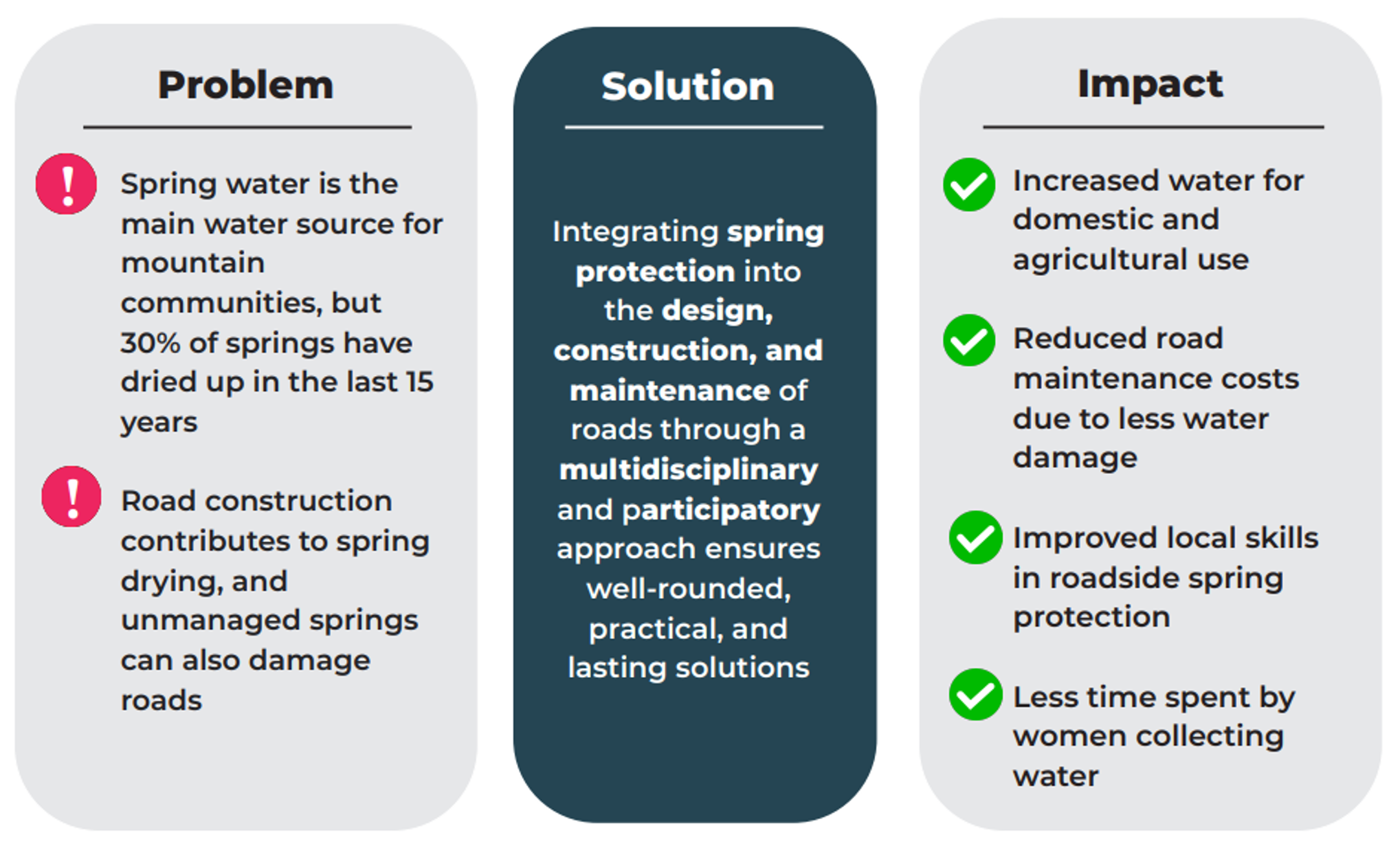
In Nepal’s Himalayan region, springs are essential for drinking water, agriculture, and livelihoods, but they face increasing threats from various factors, including poorly planned road development.
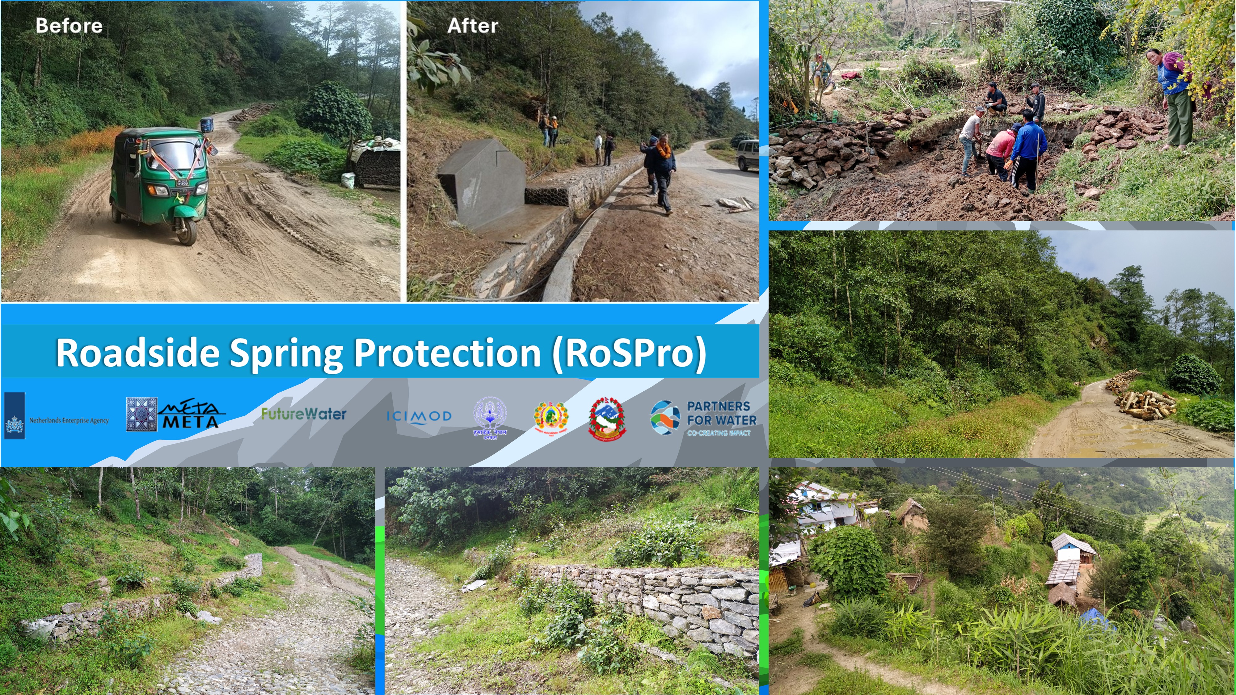
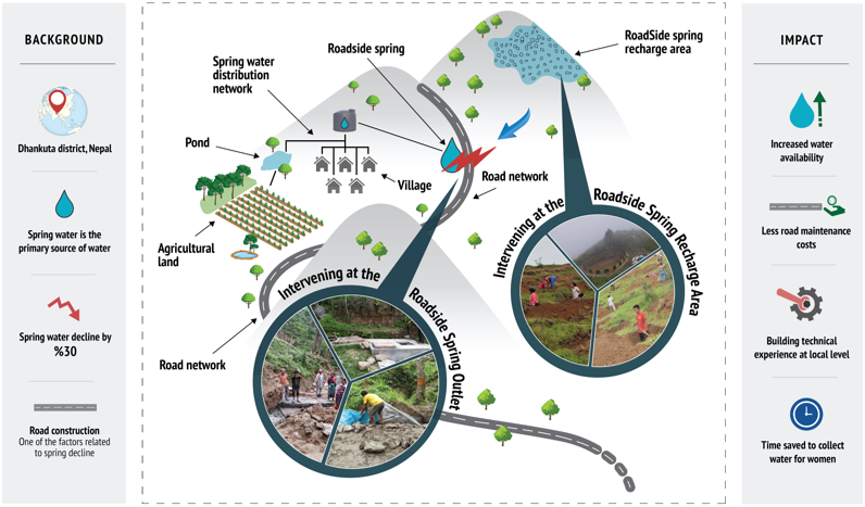
The Roadside Spring Protection (RoSPro) project, funded by Partners for Water program (PvW) and led by MetaMeta in partnership with ICIMOD and FutureWater, is tackling this challenge by aligning road infrastructure with hydrogeological and community needs in Dhankuta district in Nepal.
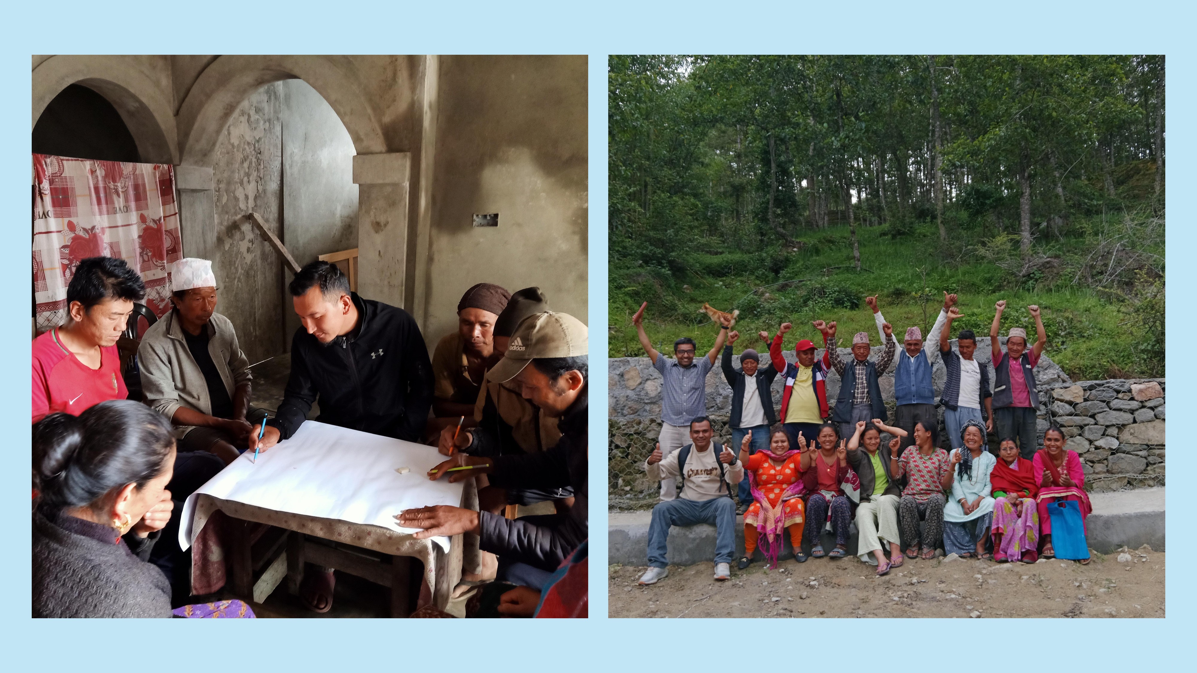
RoSPro follows a participatory approach, working closely with local stakeholders to identify vulnerable springs, co-design interventions, and implement them at two levels—spring outlets along roads and spring recharge areas. This holistic approach not only secures vital water resources but also ensures sustainable road infrastructure.
The RoSPro project aims to enhance water safety and water security in densely populated mountain areas suffering from climate-induced water stress and misguided infrastructure development.
The RoSPro approach emphasizes two levels of intervention:
• Roadside Spring Outlets – where natural springs meet road infrastructure
• Roadside Spring Recharge Area – the land area where water naturally replenishes the spring
Importance of springs:
✅ Around 80% of the mid-hill region's population relies on springs for domestic, agricultural, and livestock water needs.
🌿 Springs support vegetation, wildlife, and river base flows.
🙏 Some springs hold cultural significance, e.g., annual rituals at Keshari Kharka spring.
👨👩👧👦 It's estimated that around 1.5 billion people directly depend on mountain spring sources for their drinking water.
🏠 Spring sources can be close to villages, reducing the need for water transportation, critical for year-round water access.
Challenges:
⛰️ Springs depend on rainwater and snowmelt, and are often affected by climate change impact.
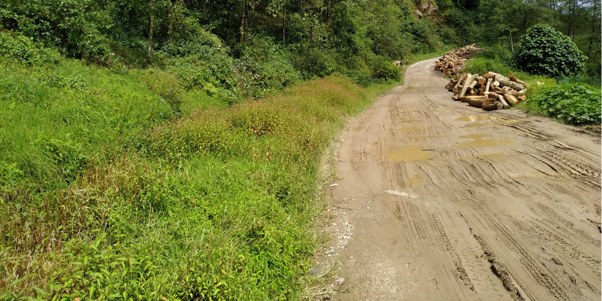
🛣️ Road construction, land-use change and deforestation threaten spring health.
📉 Decreasing water discharge (25–50% over the last decade).
Aim of the project:
🛠️ Secure roadside spring sources through suitable interventions.
💰 Reduce road damage and maintenance costs by managing seepage from spring water.
♻️ Enhance sustainable water management practices in local communities.
✅ Conduct pre- and post-intervention impact assessments to measure project effectiveness.
Local context
The RoSPro project has been implemented in Dhankuta district, Koshi Province, Nepal. It covers approximately 891 square kilometers with an elevation range of 243 to 629 meters above sea level. The district has abundant water resources, including major rivers like Tamor, Arun, and Dudh Koshi, and a high number of natural spring sources.
The local context of the RoSPro project is characterized by a diverse and evolving demographic and socio-economic landscape. The user communities surveyed represent a mix of gender, age, ethnic backgrounds, educational levels, and livelihood sources. Women comprised a significant 74% of respondents, highlighting their central role in household water collection and management.
Educational attainment among respondents is generally low, with 38% being just literate and 21% non-literate. Only a small fraction—2%—have reached graduate-level education or higher. Economically, households are primarily dependent on crop cultivation and livestock farming, with smaller portions engaged in business, remittances, government services, or labor.
Around 89% of surveyed households rely on spring water, with an average dependency of 20 years. Many collect water via direct pipe connections and store it in drums, gagris, or other vessels.
Spring water remains essential for daily life in Dhankuta, supporting household, agricultural, and livestock needs. However, water scarcity, environmental changes, and road development are creating serious challenges, making sustainable water management and community-driven solutions crucial for long-term resilience.
Roads and Spring connections
The road network in Dhankuta district, particularly in the four RoSPro project spring sites (Chanchala Devi, Bojhe, Keshari Kharka, and Dhoje Dhara Pani), plays a crucial role in connecting rural communities to markets, healthcare, education, and employment opportunities. However, many challenges exist due to poor road construction, lack of drainage, and water-related damage.
The connection between roads and spring sources in Nepal has historically been overlooked in both infrastructure development and water resource management. Although studies and local observations have increasingly pointed to road construction as a major contributor to the degradation and drying up of springs, this issue has received limited attention in engineering design, planning, and policy implementation. The absence of clear cost-benefit evidence, combined with the lack of technical expertise in road projects at the municipal level, has meant that road development often proceeds without consideration for subsurface hydrology. Despite the existence of national guidelines and technical protocols for roadside spring protection, practical examples of their application remain scarce, and the approach is still largely untested at scale.
Addressing this gap is essential given the dual threats of water scarcity and infrastructure vulnerability. Springs are vital for drinking, domestic use, and agriculture in Nepal’s mountain regions, but their declining discharge—often exacerbated by road cuts and unmanaged runoff—puts community livelihoods at risk. Simultaneously, unchecked spring seepage undermines road stability, leading to higher maintenance costs and safety risks. Integrating spring protection into road design not only safeguards critical water resources but also contributes to road durability. The RoSPro project generates evidence through pilot interventions, showing how roads can become instruments of landscape restoration and water security.
DHANKUTA, KOSHI PROVINCE
Four springs, one shared landscape
Explore the project district and the four selected spring sites.
Project Phases
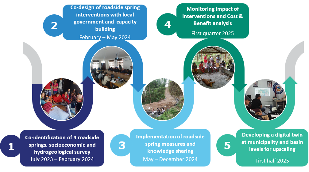
1. Baseline Study & Stakeholder Engagement
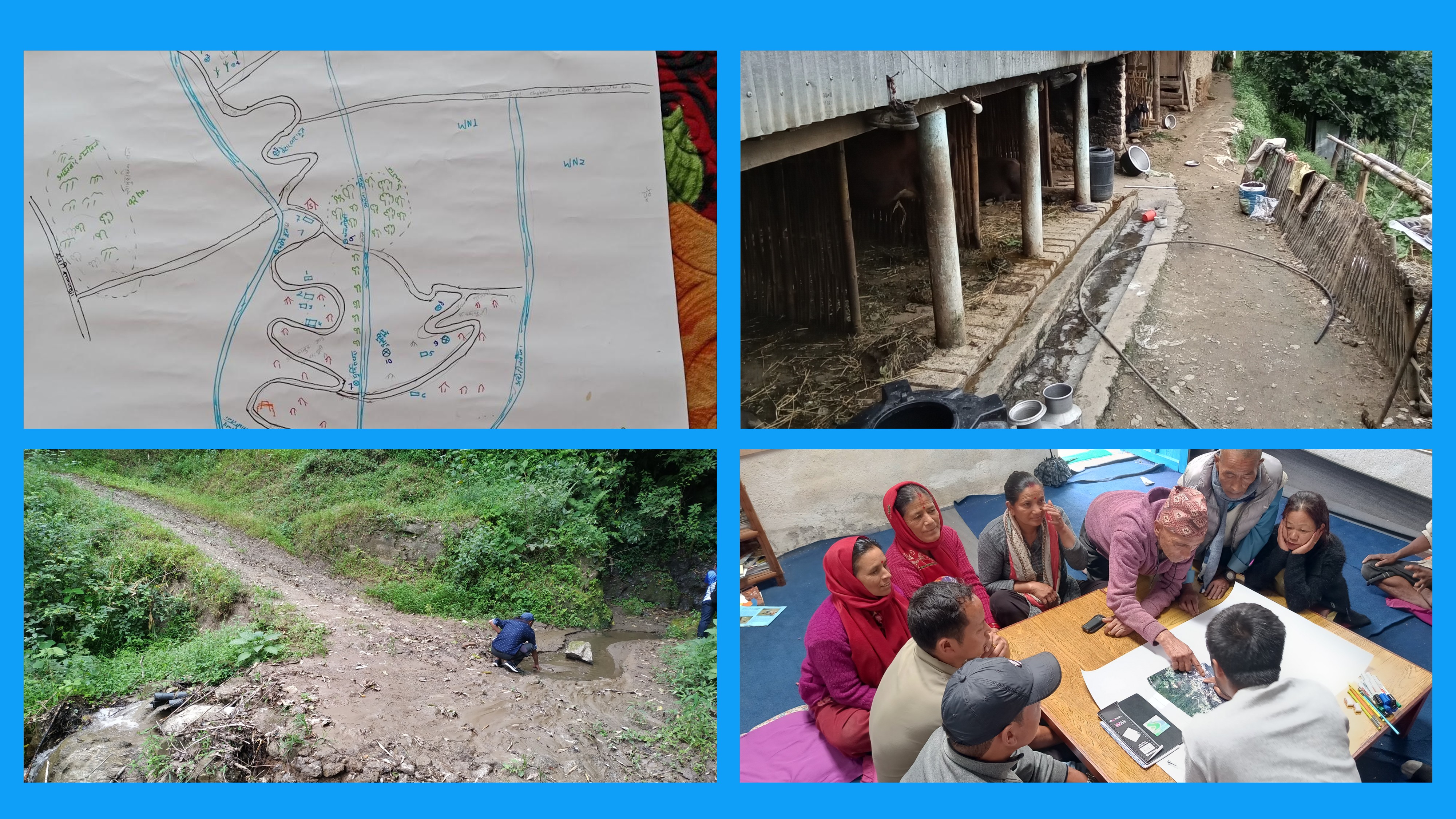
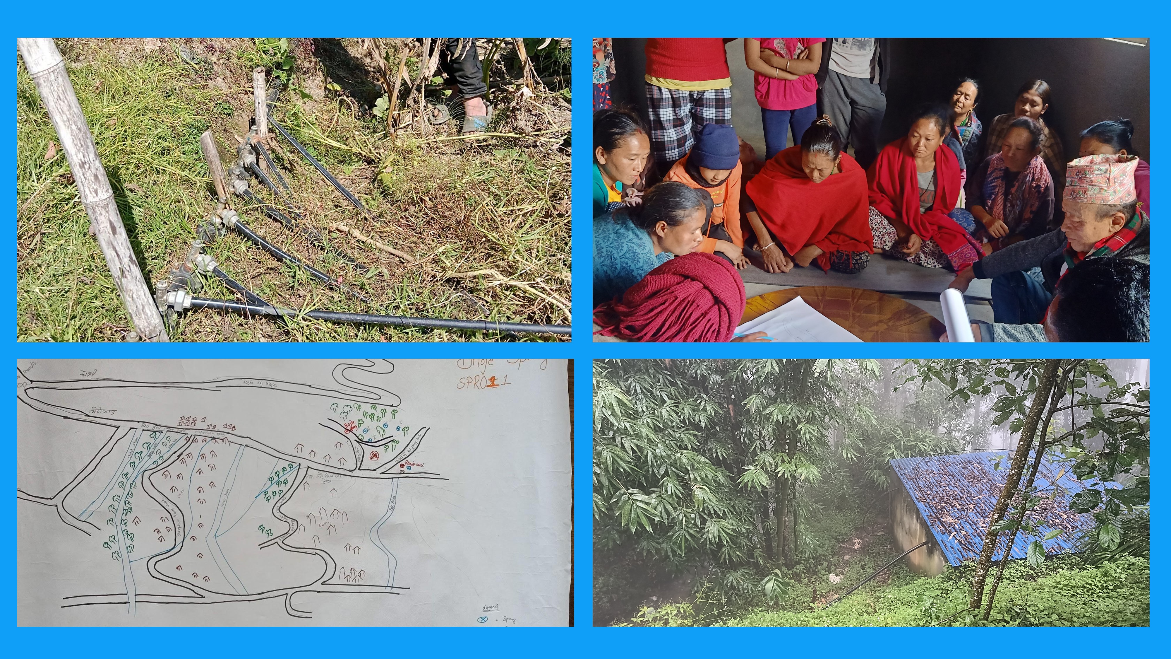
An initial workshop was conducted with 34 representatives from local municipalities, government agencies, and NGOs to select four spring sites.
This baseline study data collection involved:
Household Surveys (HHS): 55 respondents to assess spring dependency and socio-economic factors.
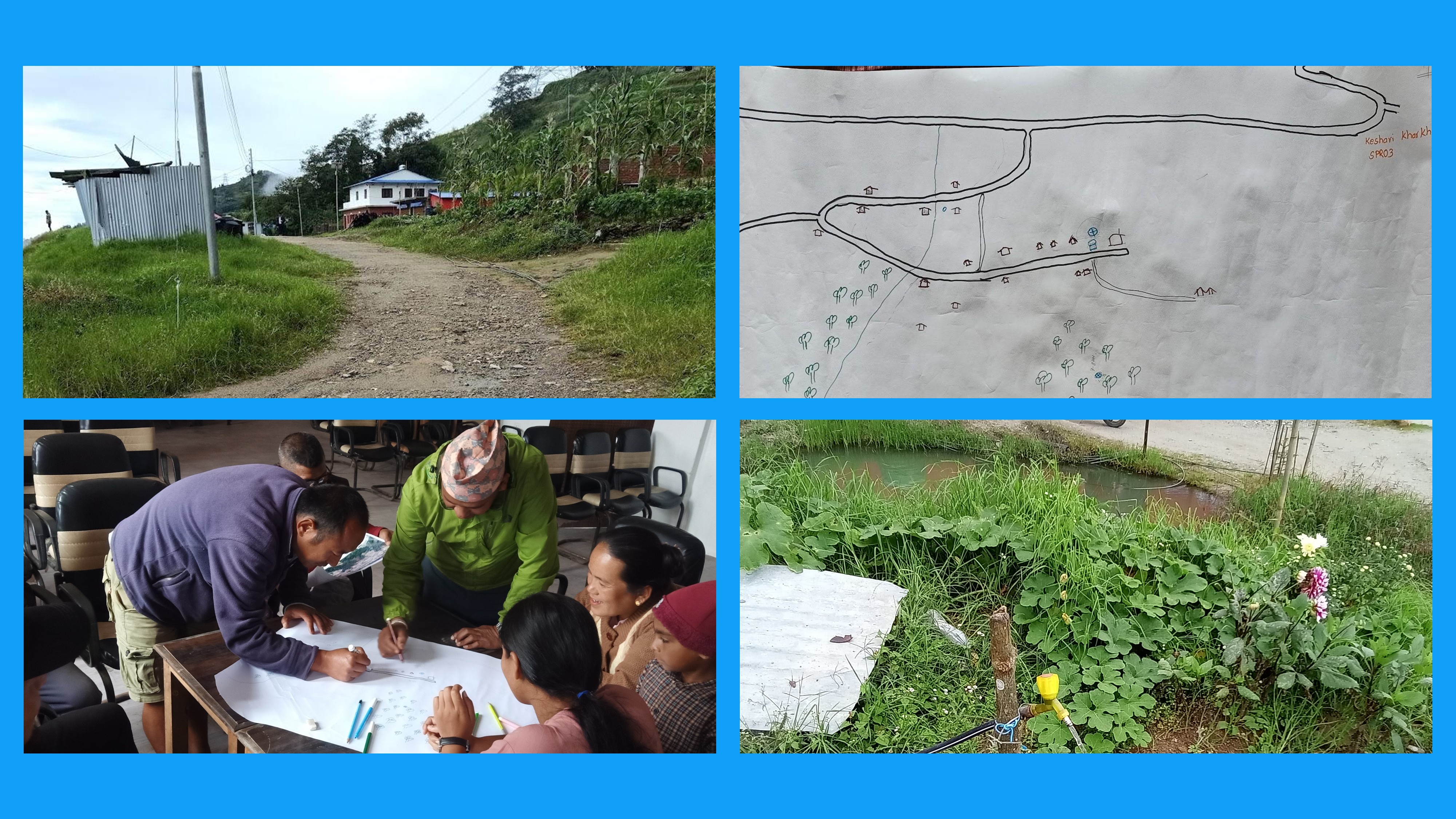
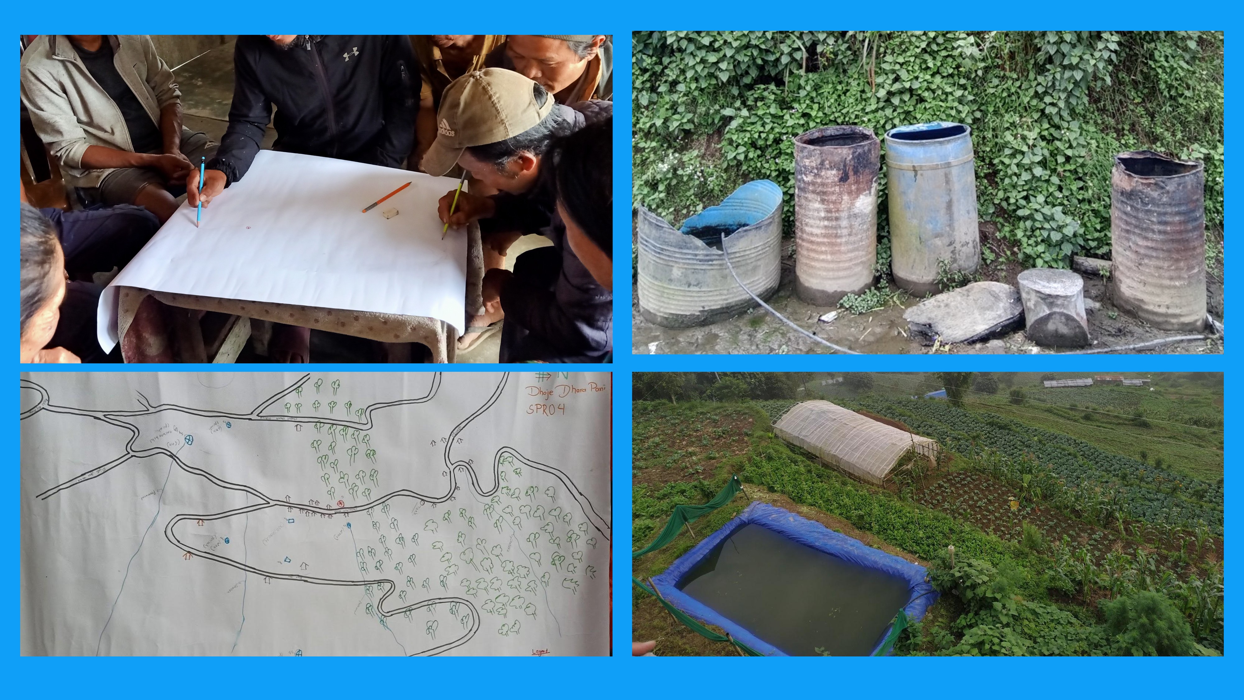
Focused Group Discussions (FGDs): 6-10 members per spring site for participatory mapping and local knowledge sharing.
Key Informant Interviews (KIIs): Insights from government officials on water, roads, and infrastructure challenges.
This phase established a foundational understanding of the community’s needs, informing the design of appropriate interventions for sustainable spring and road management.
2. Co-design of roadside spring interventions with local government and capacity building
In this phase, community members and experts worked together to develop interventions that effectively balance the need for spring protection with road development. The collaboration focused on identifying solutions for spring conservation, including the creation of recharge ponds, afforestation efforts to enhance groundwater recharge, and controlled water harvesting techniques to ensure sustainable water availability. In parallel, infrastructure-based solutions were explored to address the challenges posed by road construction, such as the installation of proper drainage systems to prevent waterlogging, the use of gabion walls for slope stabilization, and the construction of sediment barriers to reduce erosion and road surface damage. This integrated approach ensured that both spring conservation and road infrastructure could coexist sustainably, benefiting the local communities.
3. Implementation of roadside spring measures and knowledge sharing
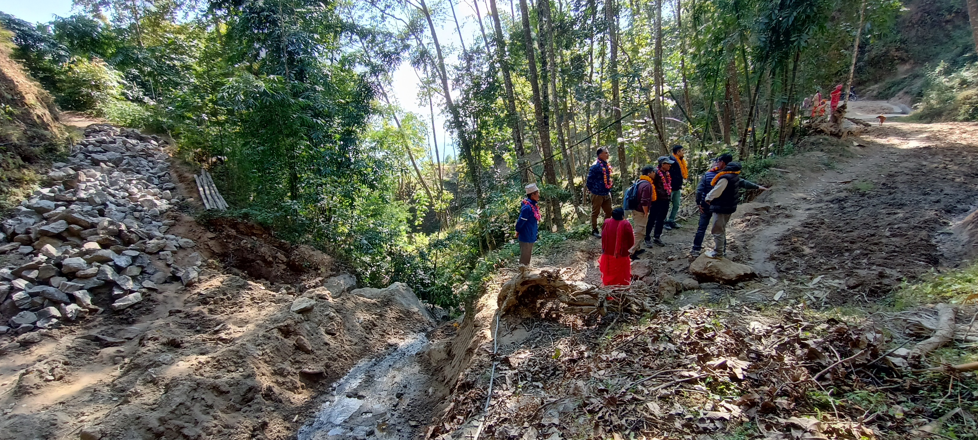
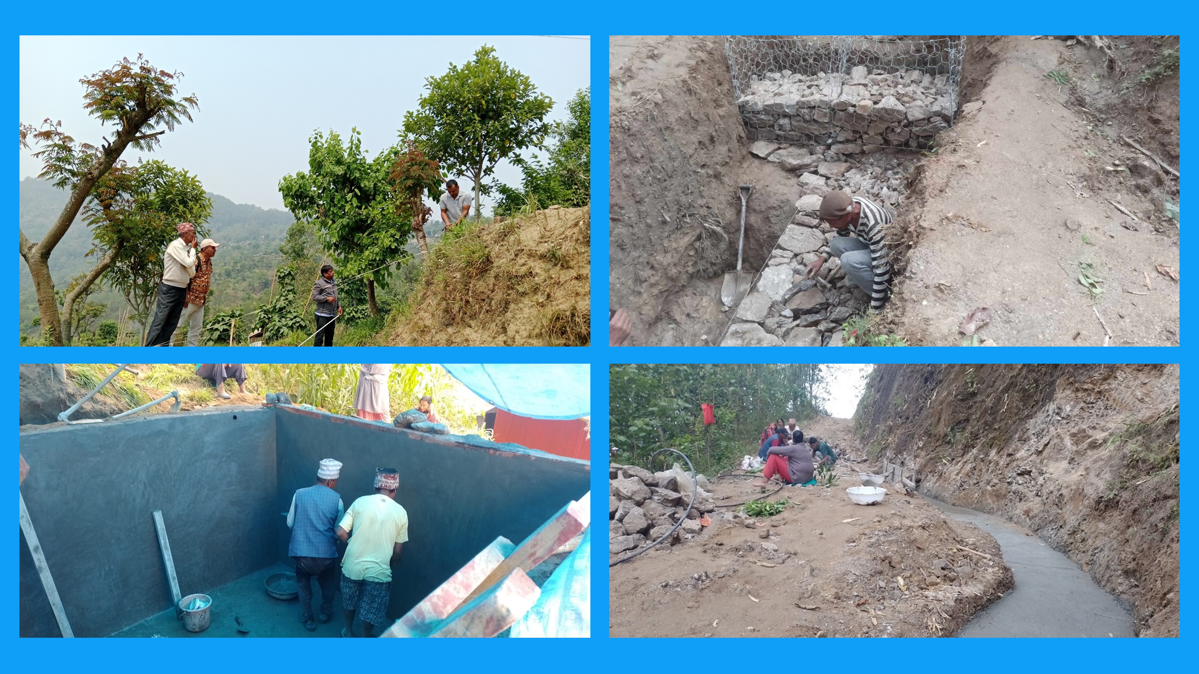
In the implementation phase, spring protection and road improvement measures were carried out across the four selected spring sites to address both water scarcity and infrastructure challenges. For spring conservation, key interventions included the construction of intake structures to control and channel spring flow, the development of recharge ponds to enhance groundwater replenishment, and the use of sediment filtration techniques to maintain water quality. On the road infrastructure side, efforts focused on installing drainage systems to manage excess water and stabilizing slopes to prevent erosion and road surface damage. Importantly, these activities were implemented with strong community involvement, with local residents actively participating in both the construction and ongoing maintenance of the interventions.
4. Monitoring impact of interventions and Cost & Benefit analysis
This phase focused on evaluating the effectiveness of the implemented interventions through a combination of technical observations and community feedback. Regular monitoring activities were carried out to track changes in spring discharge and assess the condition of adjacent roads, providing critical data on the physical outcomes of the project. Alongside this, the team conducted evaluations to measure improvements in water availability and quality, comparing post-intervention conditions to the baseline situation. To ensure that local perspectives were integrated, the project also gathered community feedback on the interventions, capturing user experiences and satisfaction levels, which helped to identify strengths, gaps, and opportunities for scaling or adjusting future efforts.
5. Developing a digital twin at municipality and basin levels for upscaling
The final phase of the project focused on knowledge sharing and scaling up, ensuring that the lessons learned from RoSPro could benefit broader efforts in water and infrastructure management.
To support these goals, RoSPro integrates a Decision Support System (DSS) anchored in a hydro-geological digital twin of the springshed and basin. This innovative approach offers a location-specific, state-of-the-art tool to assess the impact of interventions and guide sustainable water and road management. The digital twin provides a detailed understanding of current hydrological conditions from the sub-basin to the basin scale. Complementing this, the DSS delivers critical information on baseline conditions, intervention cost-benefit analyses, and strategies for evidence-based, informed decision-making.
The selection process for the 4-spring source took place during a workshop in Dhankuta Municipality.
A total of 34 participants, representing local communities and various government offices at the central and provincial levels, actively participated in the decision-making.
The selection criteria for selecting 4 spring sites included:
High dependency on the source of water
Types of usage use, drinking, domestic or irrigation
Number of people/HH
Decreasing discharge in spring source
Impacted by road or impacting the road.
Plans for roadside construction / upgrading
Accessibility
Road location at feeder / agricultural road
Diversity in elevation (mid-hill, upper, etc.)
Willingness of the people to engage – ward members will express.
Potential for leveraging – other programs.
Manageable source / recharge area
Implementations
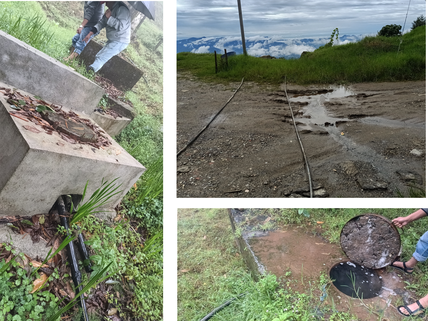
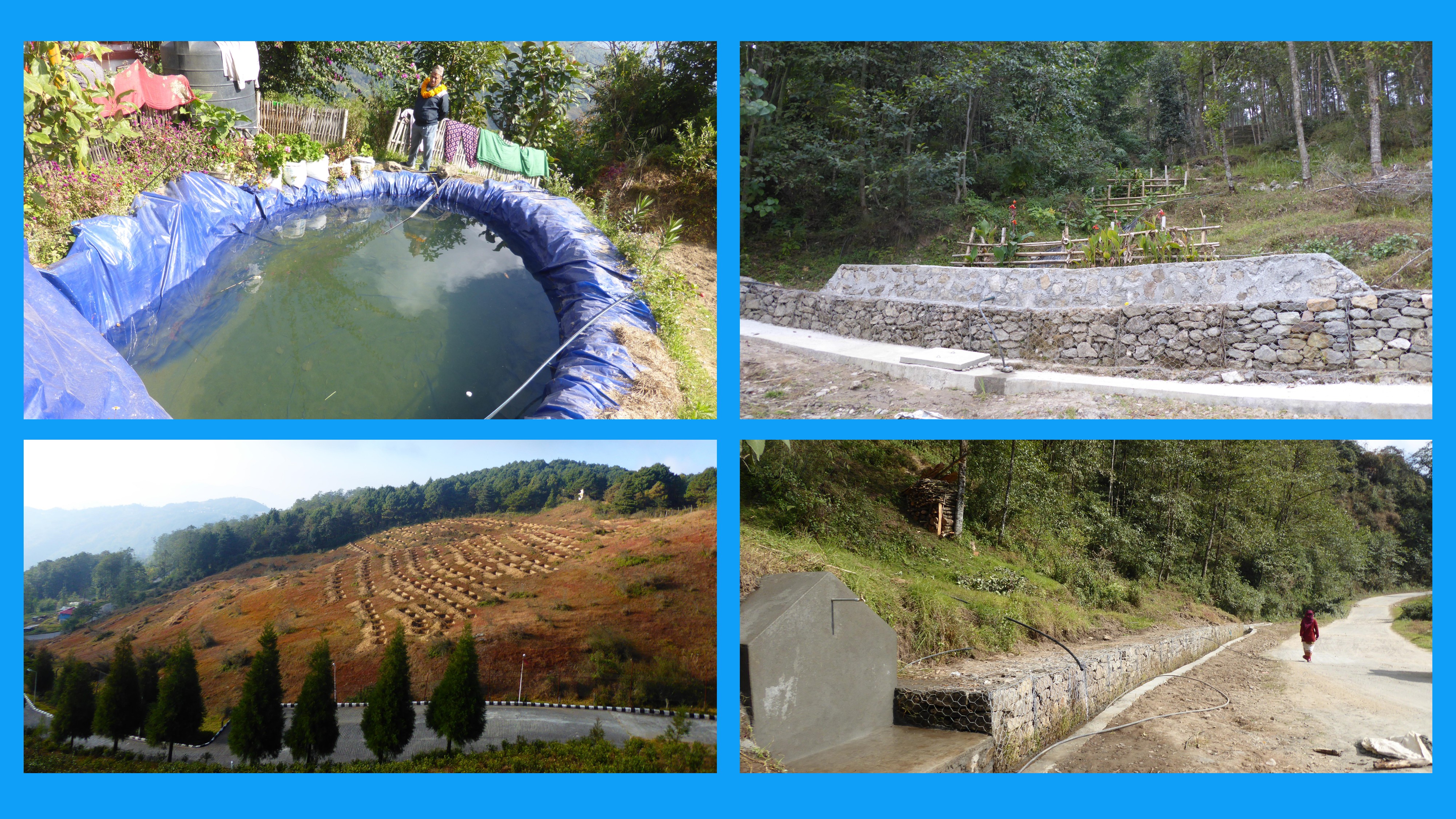
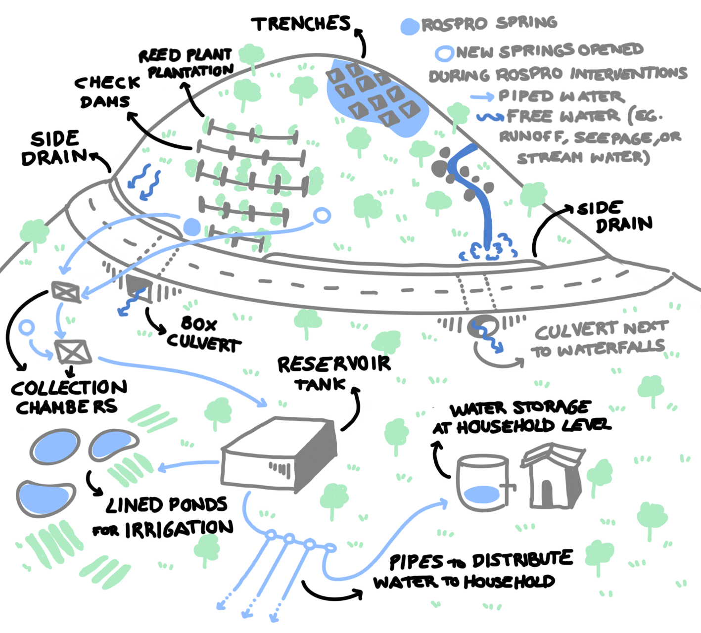
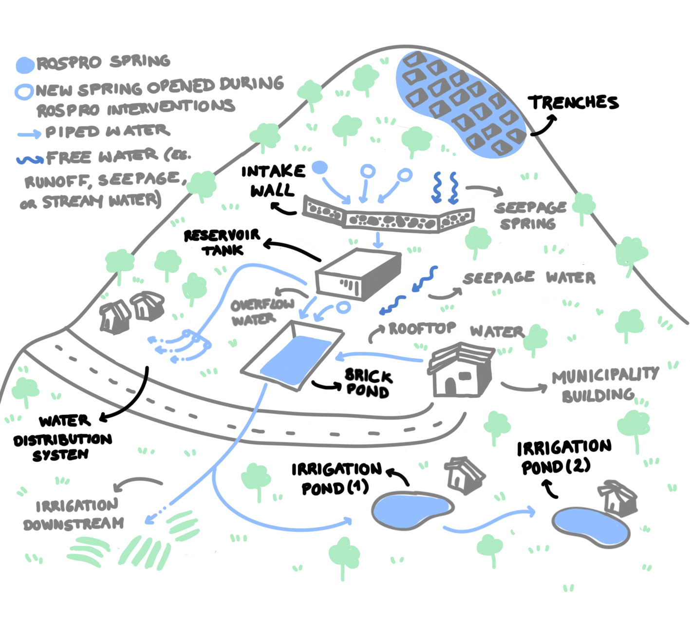
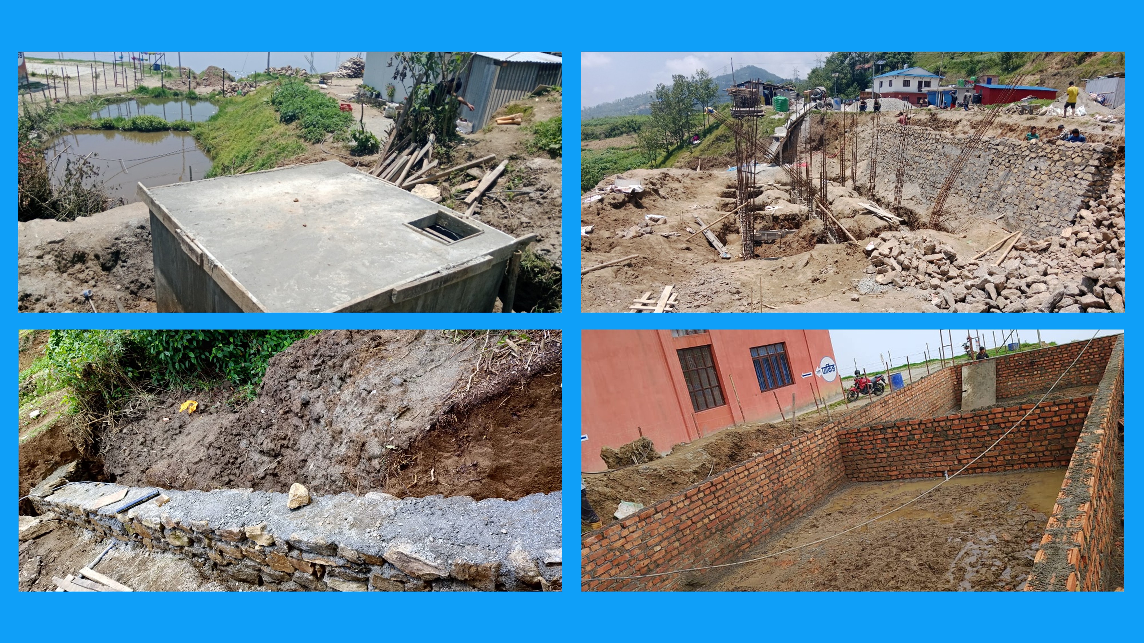
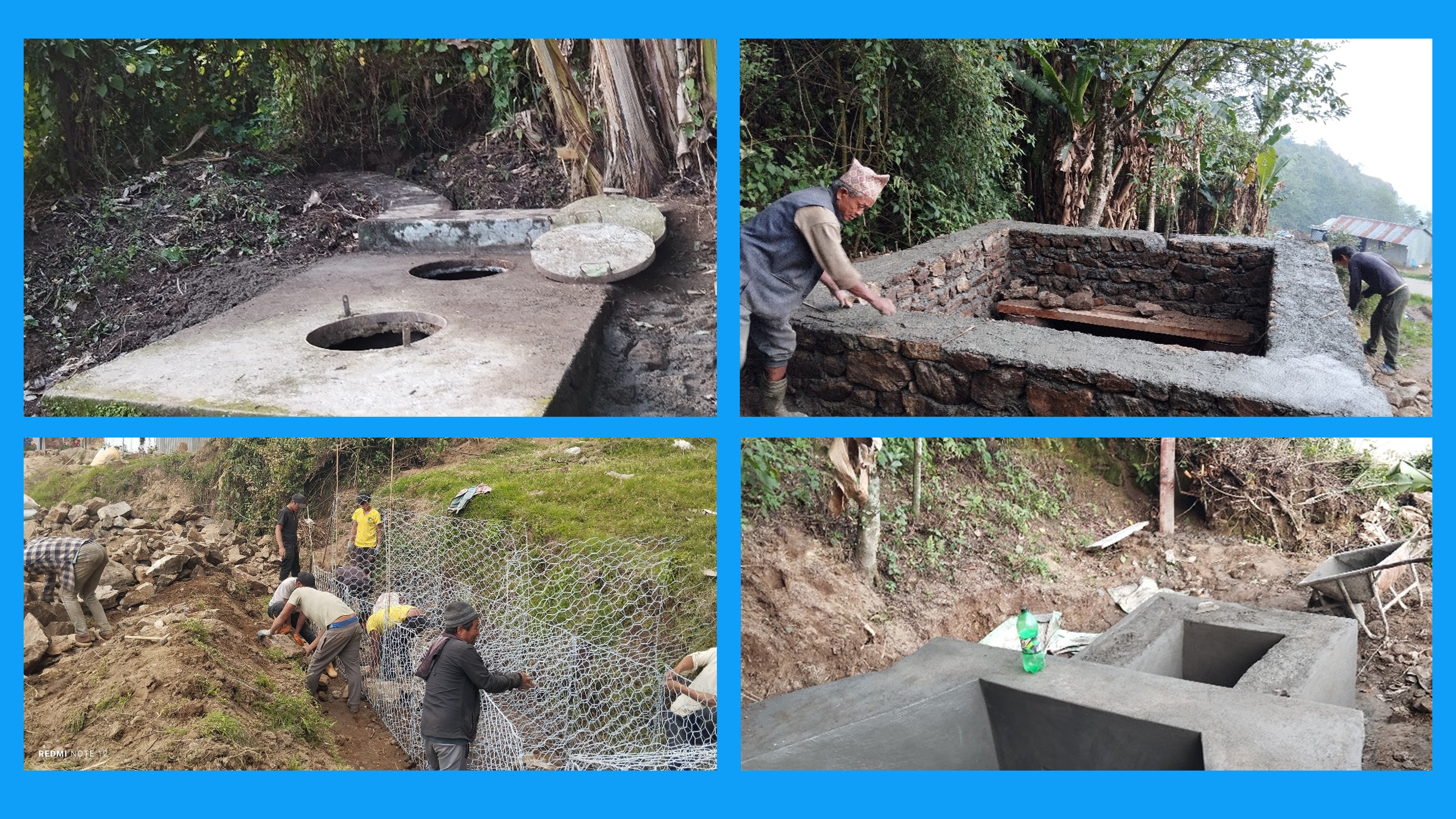
Within the RoSPro project, a range of integrated and site-specific interventions were implemented across the four spring sites selected. These interventions were tailored to each location’s hydro-geological and socio-economic context and brought measurable improvements in water availability, road usability, land stability, and community livelihoods. At each site, spring water was harnessed through intake structures, routed via collection chambers to reservoir tanks, and then distributed to households through dedicated pipeline networks. To maximize water use efficiency, overflow water from reservoir tanks was captured in plastic or brick ponds, supporting small-scale irrigation and enhancing agricultural productivity. In addition to water management, erosion control measures such as check dams, slope plantations, and gabion structures were implemented to stabilize hillsides, prevent landslides, and protect road infrastructure. A critical focus was also placed on road drainage systems, including U-shaped, V-shaped, and earthen drains, to safely redirect runoff and prevent contamination or damage to the spring sources and roads. These combined measures significantly improved spring discharge reliability, enhanced access to clean water, supported climate-resilient agriculture, and strengthened the mobility and safety of communities, ultimately contributing to more resilient and sustainable livelihoods in the Dhankuta district.
02 / COMMUNITY PERSPECTIVES
The household baseline survey
Explore the original survey results across the four spring communities.
Source: RoSPro baseline survey. Counts are responses, except where years are specified. Blank source entries are unavailable and are shown as a dash.
View survey values
03 / THE SPRING STORIES
Selected springs description
Choose a spring on the map or in the buttons to explore its story.
Chanchala Devi
Baseline Status
The Chanchala Devi Spring has been in use for 30 years, but over the past decade, the number of households dependent on it has decreased due to declining water quantity and quality. Water is collected in small drums for livestock and stored in unlined ponds for agricultural use, with a pipe connection serving 6 households downstream. The water supply is unreliable, especially during the monsoon season, due to sedimentation, erosion, and road runoff. Key income sources of dependent households include crop cultivation, livestock, remittances, and government services. Community development programs, such as afforestation, road construction, and soil conservation, are active, though road accessibility is limited during the monsoon.
Implementations
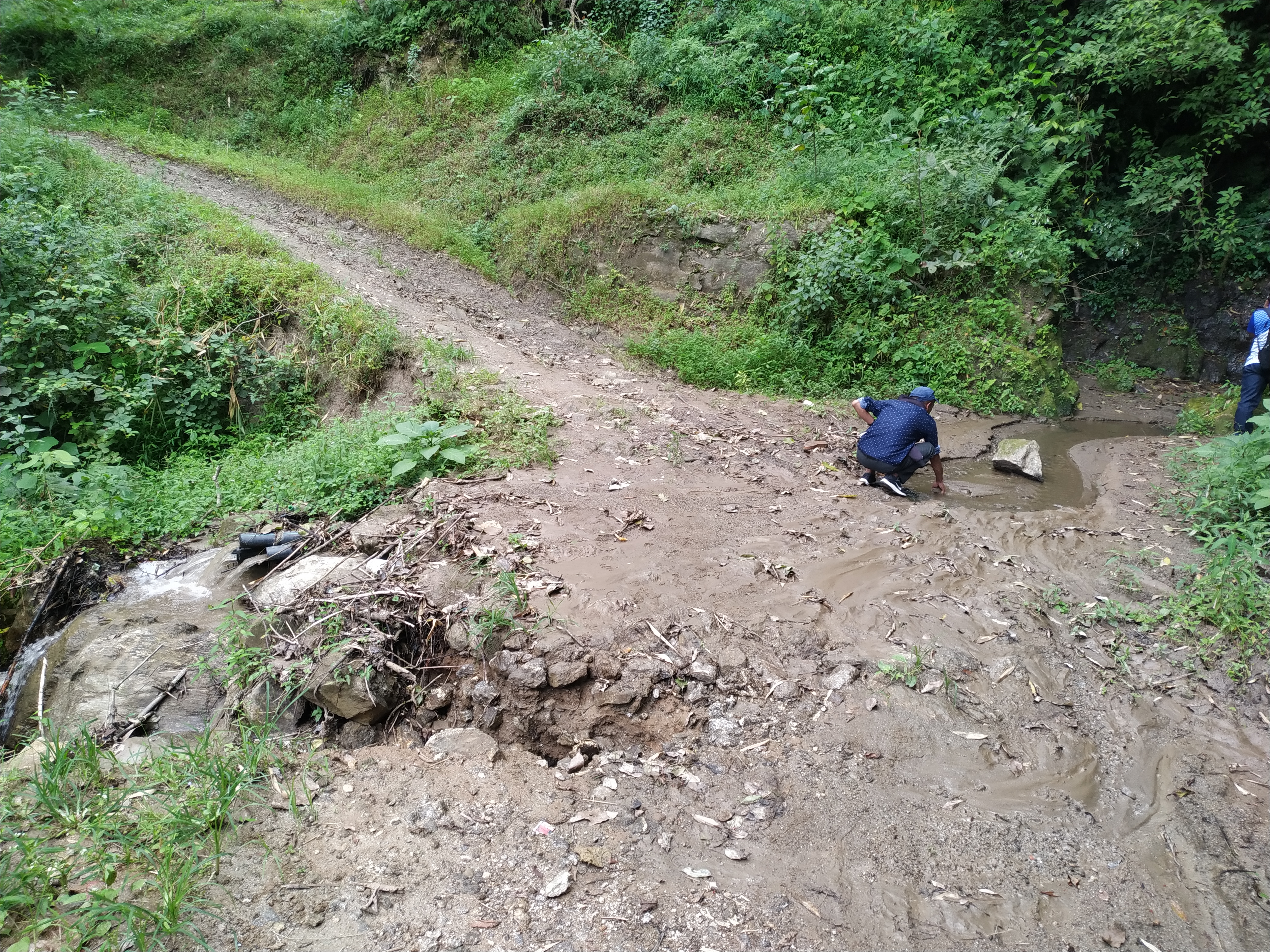
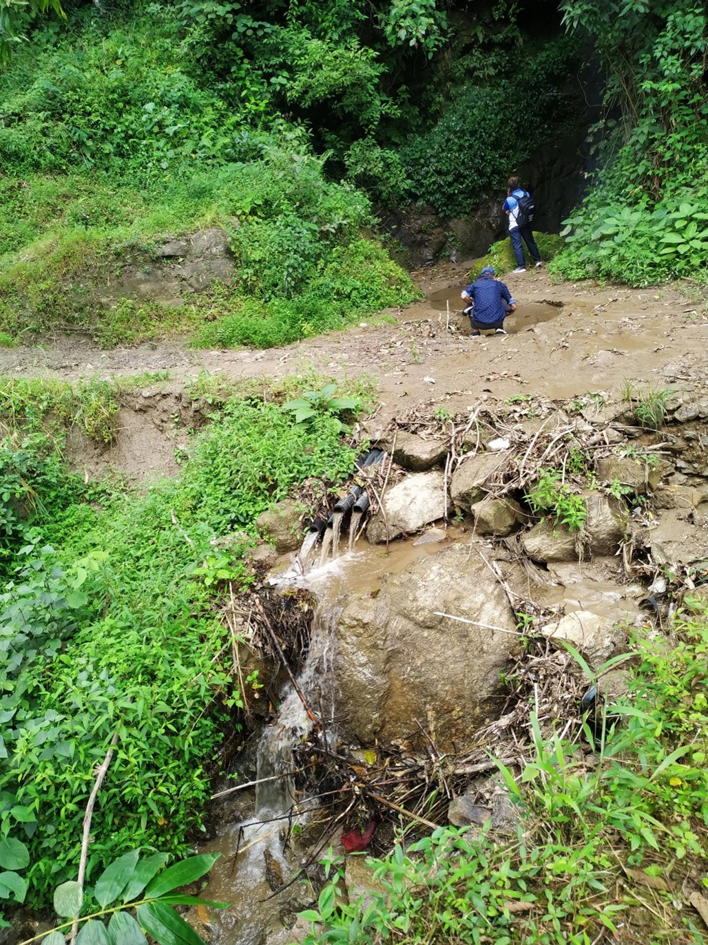
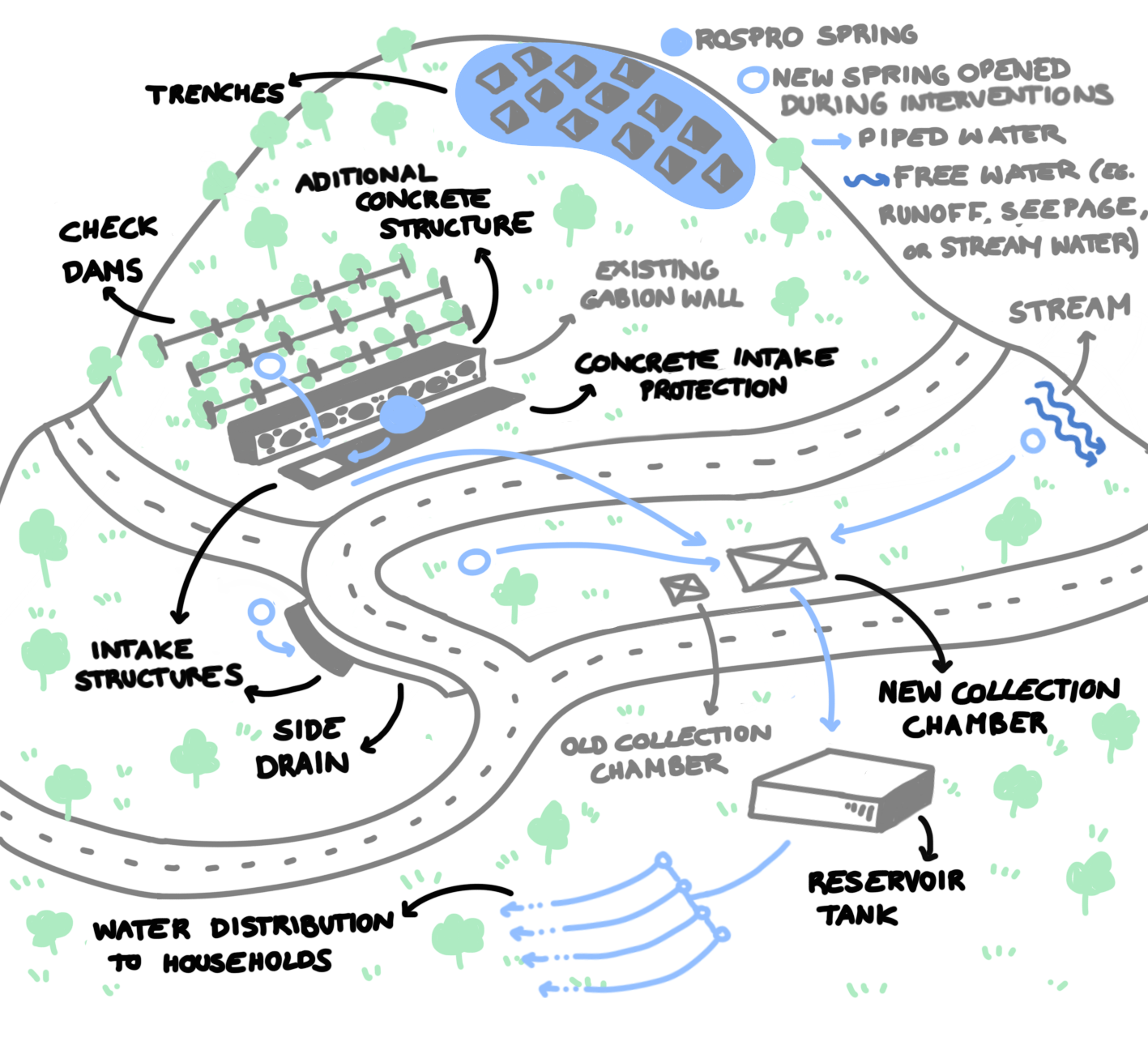
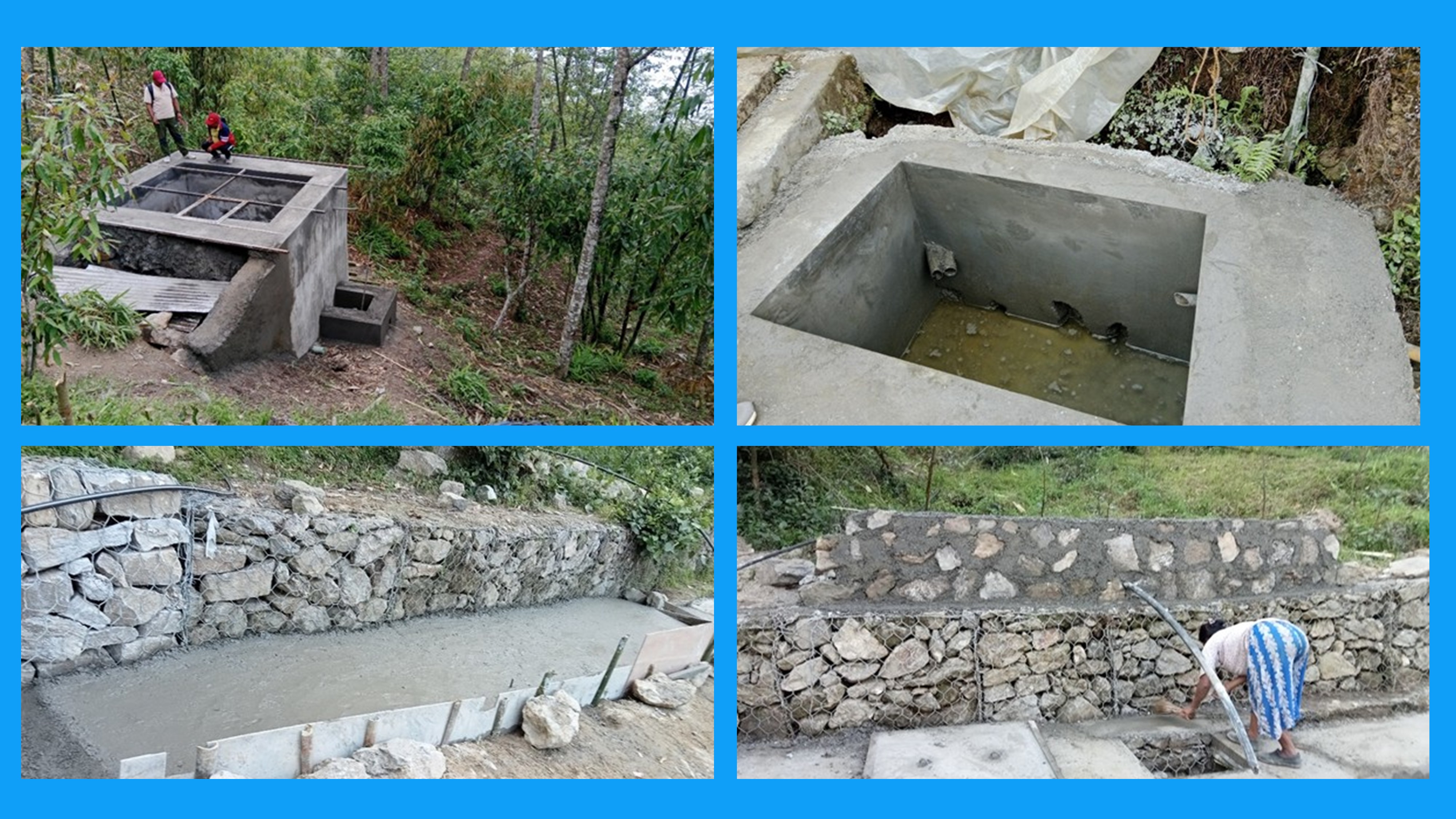
Water from one newly opened spring and two existing springs is collected in a small intake located below the roadside near a box culvert. From there, the water flows into a collection chamber before being transported to a reservoir tank via a pipe system. The water is then distributed to individual households through a network of pipelines. To prevent road runoff from contaminating the spring source, a well-structured drainage system has been implemented. Road water is efficiently managed and directed away using a combination of U-shaped, V-shaped, and earthen drains, which channel the water into the box culvert and eventually into nearby rivers. Additionally, measures have been taken to protect the spring source from erosion and landslides. Check dams have been constructed, and plantation activities have been carried out above the spring source to enhance slope stability and prevent soil degradation. Furthermore, three plastic ponds have been constructed to collect overflow water from the reservoir tank, which farmers use for irrigation purposes. Sketch I below represent the layout of the implemented measures.
Improvements
• Water Availability: Increased by 20-25%, allowing 6 households to access water for 12 hours daily. This improvement was achieved through the installation of collection chambers and better distribution systems.
• Water quality: 67% of respondents reported direct use of spring water without any treatment practices.
• Agricultural Productivity: farmers have harvested pea, potato, maize and millet.
• Community Involvement: Strengthened local governance and community mobilization for spring protection.
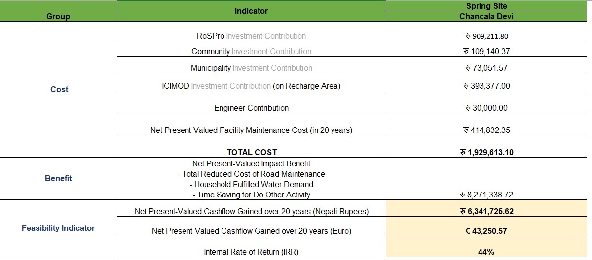
Cost & Benefit
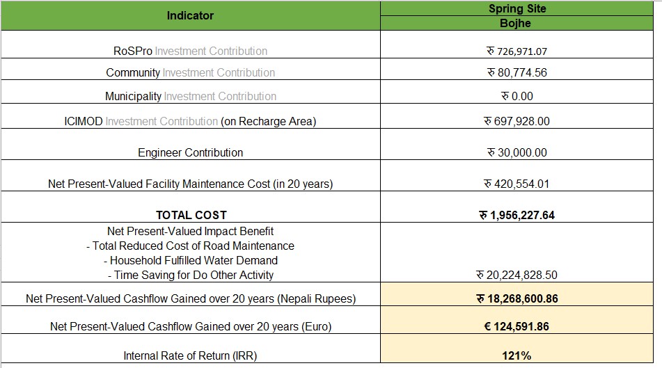
Bojhey
Baseline status
The Bojhey Spring serves as a vital water source, with 86% of the surveyed households reporting full dependence. Water is collected via a piped connection from a collection tank, supporting households that primarily rely on crop cultivation and livestock. During the monsoon season, sediments and road runoff from upstream frequently clog the pipes, disrupting the water supply and forcing households to spend additional time managing their daily water needs.
Implementations
Several implementations have taken place in Bojhey. Water from both the existing spring and newly opened springs is collected at the intake, then directed to a collection chamber before being stored in a reservoir tank. From the reservoir, the water is distributed to households through a network of pipelines. Additionally, check dams and plantation activities have been carried out above the spring area to enhance soil stability, prevent erosion, and protect the water source
Improvements
• Water availability increased significantly, with a 20–30% rise in spring water volume reported by users. This was achieved through new intake systems, collection chambers, reservoir tanks, and better distribution via household pipelines.
• The water collection process became more efficient, with many households now using personal or shared taps rather than fetching water directly from the spring
• Water quality improved, thanks to the construction of protective measures like masonry walls, check dams, and bioengineering interventions to control upstream runoff and erosion
• In terms of agriculture, households connected surplus water from their home pipelines to sprinkler systems, leading to more reliable irrigation and better crop management
Cost Benefit
Keshari Kharka
Baseline status
The Keshari Kharkha Spring has been in use for 30 years, and over the past decade, the number of households dependent on the spring has increased due to improvements in water availability and water quantity reported by the community. Water is collected through a pipe connection and stored in drums for domestic use, while unlined ponds are used for agricultural needs and infrastructure development. Agriculture faces challenges from unreliable water supply, sedimentation, and erosion, worsened by rising temperatures and declining rainfall. Major income sources include crop cultivation, business, livestock, remittances, and government services. Community development programs focus on afforestation, road construction, and soil conservation. However, the area faces issues such as road surface damage, gully formation, and a lack of drainage systems near the spring, making accessibility difficult, especially during the rainy season.
Implementations
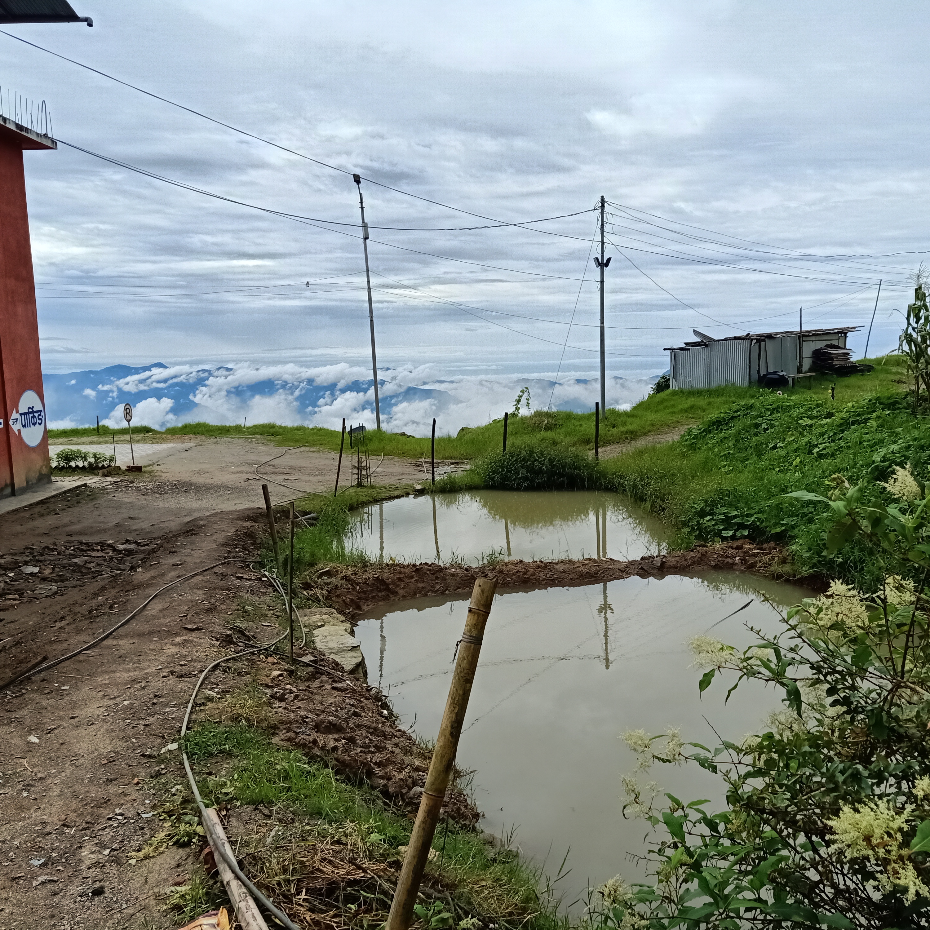
At the Keshari Kharkha Spring Site, water from the spring is collected through an intake system and directed to a reservoir tank via a pipeline. From the reservoir, the water is then distributed to households through a network of pipes. To maximize water utilization, overflow water from the reservoir tank, along with rainwater collected from the CJRM office roof, is directed into a brick pond. Farmers then use this stored water by transferring it to a constructed plastic pond for irrigation purposes, ensuring efficient water management and agricultural support.
Also, the water from that pond is used in the development activities such as construction of buildings, roads etc. in the community.
Improvements
• Water Availability: Water quantity increased by 20-30%, providing more reliable access for domestic and agricultural needs.
• Water quality: Significant reduction in sedimentation and erosion thanks to improved watershed management.
• Road Infrastructure: The construction of the feeder road and gravel surface improved accessibility to the spring, though drainage issues remain a concern.
• Agricultural Impact: additional water resources are used for irrigation purposes
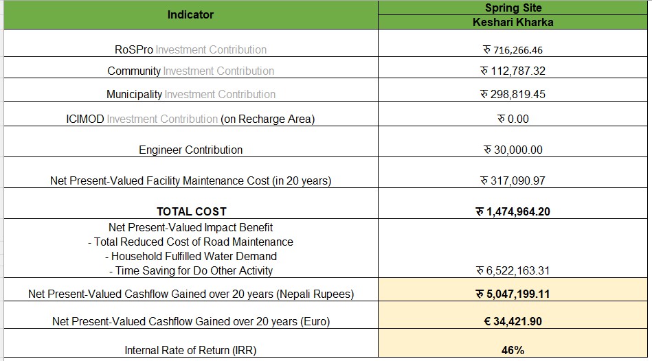
Cost Benefit
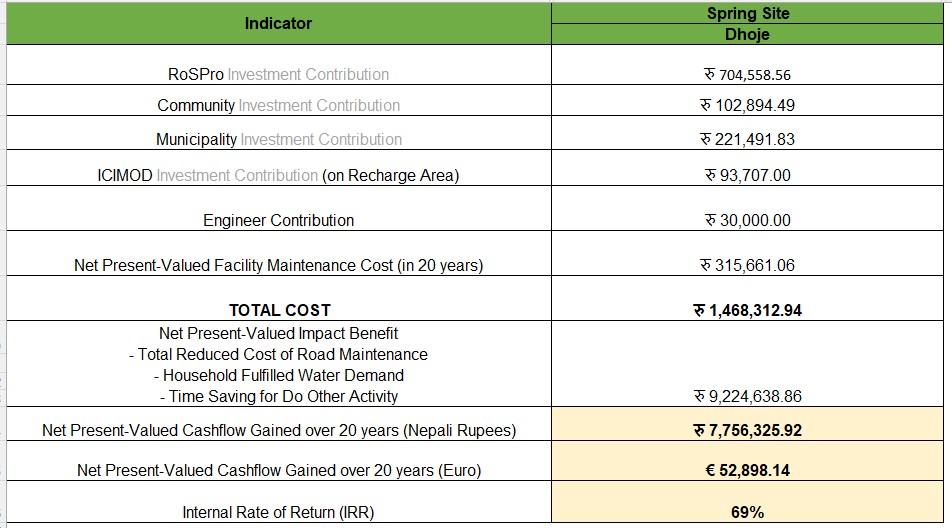
Dhoje
Baseline status
The Dhoje Dhara Pani Spring has been a crucial water source for the community for 16 years. Water is collected through a pipe connection, stored in small drums for livestock, and in plastic ponds for agricultural use. Agriculture faces significant challenges such as water stress, sedimentation, and erosion, further exacerbated by rising temperatures and declining rainfall. The community has access to various development programs, including afforestation, road construction, soil conservation, and field bunding. However, the area faces infrastructure challenges, such as the absence of a drainage system near the spring and road access limitations, especially during the monsoon season. Each household must connect their HH pipes directly to the source. This method is inefficient and required daily trips to the spring to manage water connections. On average, community members spent 30 to 60 minutes each day fetching water, which was both physically demanding and time-consuming.
Implementations
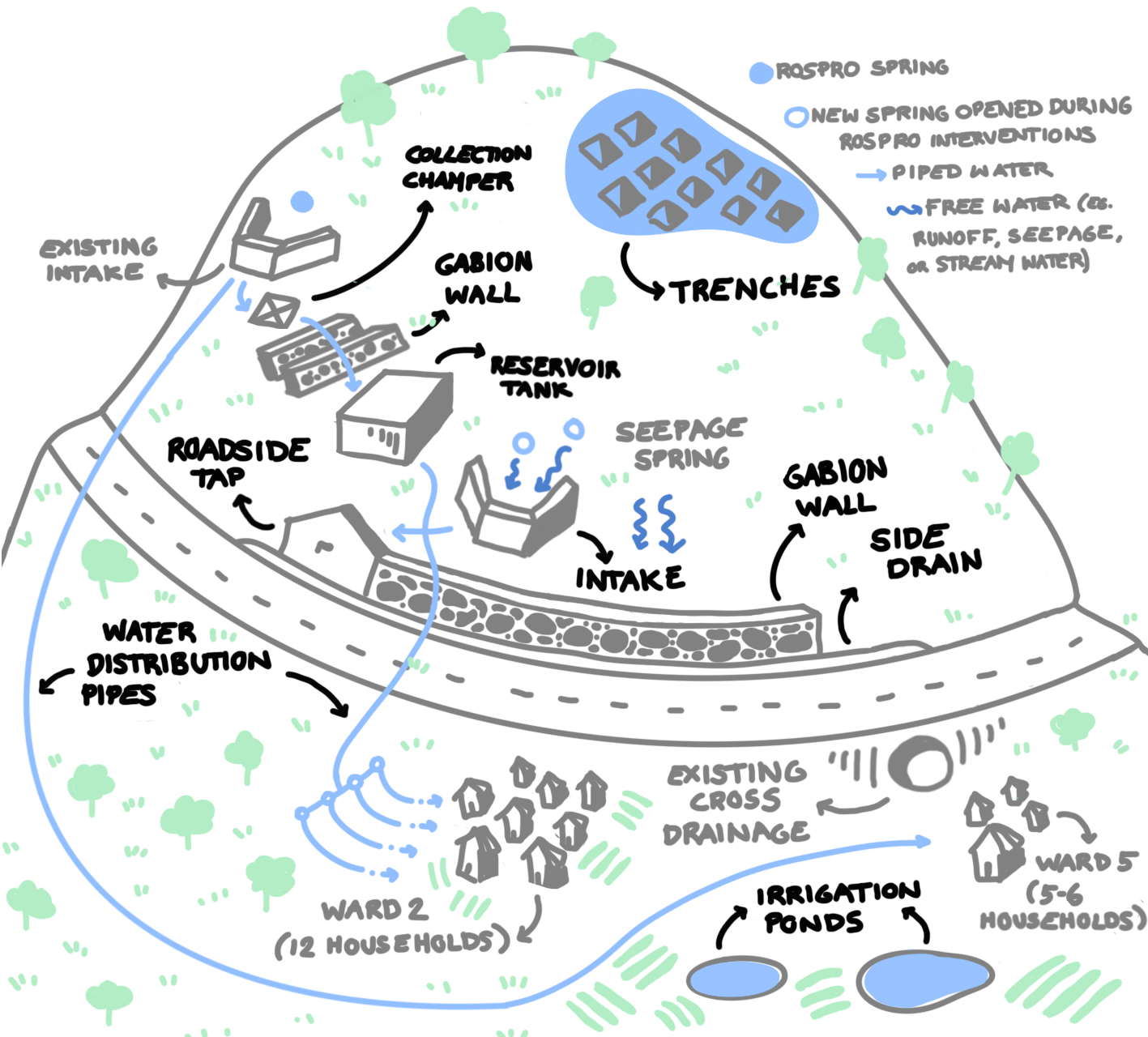
At the Dhoje Dharapani Spring Site, water from the spring is collected through an intake structure and directed into a collection chamber. From there, it is stored in a reservoir tank, which then distributes water to households through a network of pipes. To enhance water utilization, the overflow water from the reservoir tank is channeled into a constructed plastic pond, where farmers use it for irrigation. Additionally, seepage water from the intake structure is directed to a roadside tap, providing water for travelers, pedestrians, and farmers for washing vegetables and other uses.
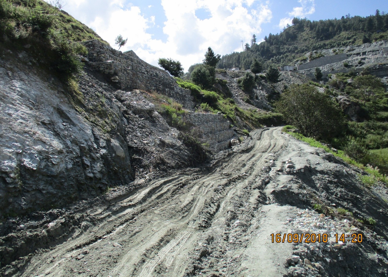
Erosion control measures have also been implemented to protect the site. A layer of gabion boxes has been placed to prevent soil from sliding onto the road and to guide seepage water into the drainage system, keeping it from accumulating on the road surface. Furthermore, to stabilize the soil near the collection chamber, three layers of gabion boxes have been installed, ensuring long-term structural integrity and minimizing erosion risks.
Improvements
• Water Availability: Ensured 18 hours of daily water availability for households, significantly reducing the time spent fetching water. Increase in spring water between 20-40%.
• Water quality: Clean water supply improved, supported by efforts to control sedimentation and erosion.
• Agricultural Productivity: More consistent water supply allowed for better irrigation and increased crop yields.
• Community Engagement: The intervention fostered a stronger community-based approach, enhancing local management and governance, particularly for water resource management.
Cost Benefit
04 / THE WAY FORWARD
Way Forward
Upscaling the approach
The upscaling of the entire approach lies in the co-design, involvement of the key stakeholders, effective implementation and governance. The local, regional and national level stakeholders play a key role in making the approach sustainable in the longer term. Use of digital-twin (SPHY) and its capability to simulate the impacts of interventions and scenarios help in scale up the learning from four springs to the other springs in the NT watershed. It is recommended to scale up investments to enhance the capacity of the stakeholder and institutionalize the technical skills gained from the project implementation. Following scaling up options are explored in the RoSPro project:
Local Level:
• Municipalities and communities are actively adopting and replicating the RoSPro approach and are committed to training others.
• An exchange visit from neighboring municipalities to RoSPro sites at the end of the project will enhance exposure to its benefits, fostering wider adoption.
National Level:
• DoLID aims to integrate RoSPro into current and future road projects in mountain areas, especially those funded by WB, ADB, and other MDBs.
• A concept note is being developed with DoLID to guide this process.
• Other sectors such as water & agriculture are seeing the benefits and showing interest.
Regional & Global Level:
Consortium partners continuously exploring RoSPro integration into regional programs and expanding to the broader Hindu Kush region.
THE DIGITAL LANDSCAPE
Basin scale
05 / EXPLORE THE BASIN
Water, terrain and spring recharge
Switch layers, explore monthly climate data and select a map cell to inspect its value.
Select a map cell to inspect its value.
Spring inventory
06 / DECISION SUPPORT
Cost and Benefits Tool
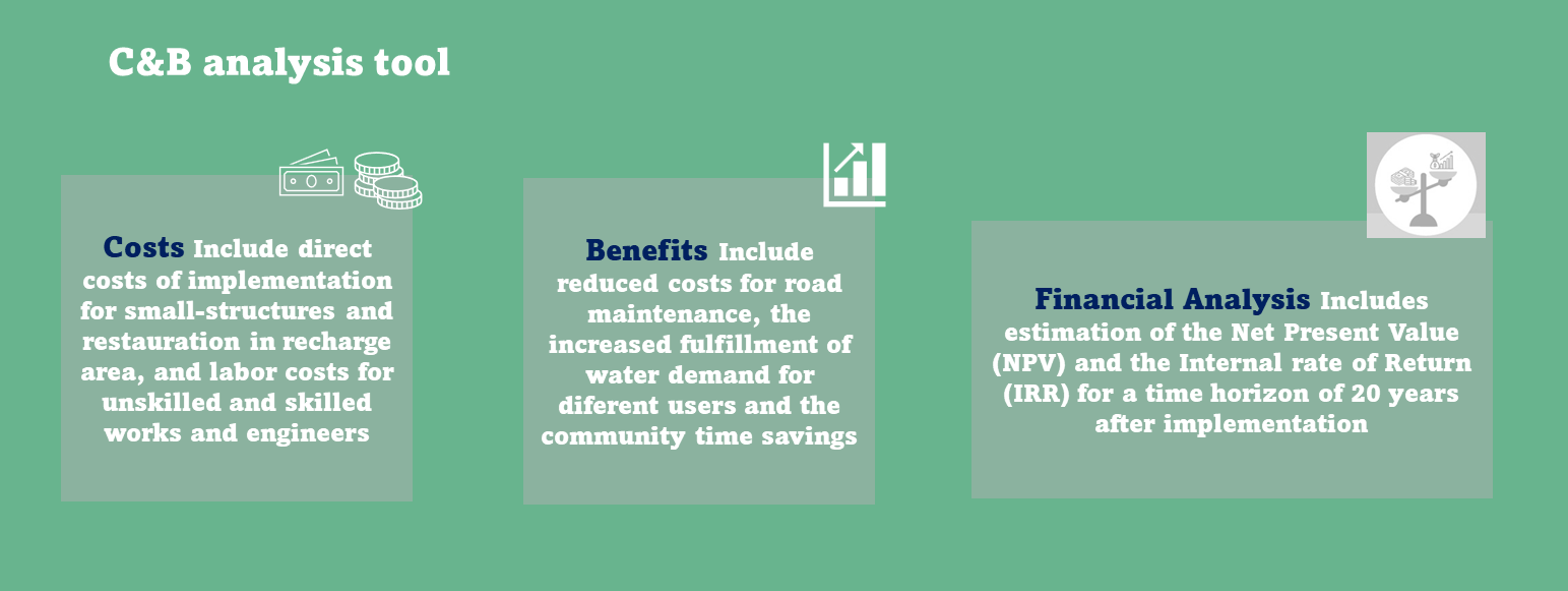
RoSPro has developed a Costs and Benefits (C&B) Tool to assist stakeholders in evaluating the potential advantages of proposed restoration and management measures for mountain springs. This tool supports decision-making by estimating the financial and practical benefits that such activities could deliver.
The analysis is grounded in data collected during the ROSPRO project, including field assessments, analytical insights, and SPHY hydrological modelling.
Key financial outputs provided by the tool include Net Annual Benefits, Internal Rate of Return (IRR) and Net Present Value (NPV).
These results are based on estimated project costs and projected benefits, such as improved water availability, reduced road maintenance expenses, and time savings for local communities.
The tool is provided as an Excel file and is available for download and local use. It includes clear instructions and explanations of the underlying assumptions to guide users through the analysis process.