Author: Martijn
9 July 2019
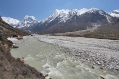
Millions of farmers depend on meltwater from Himalaya glaciers
Last month new research showed that in the past 20 years, glaciers in the Himalaya were melting at a higher rate than in years before. Crop production and livelihoods of around 129 million farmers depend on meltwater from these glaciers. This is shown by an international group of researchers, including FutureWater team members, in a...
5 July 2019
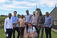
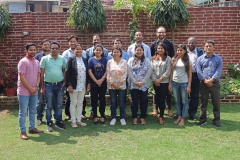
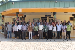
Rwandese experts visit the Netherlands for a training on water management
This week a team of experts from the Rwandese government visited the Netherlands to learn from the Dutch water authorities about their experience on water management. The focus was on peat dikes, as this mission was embedded in a joint effort of the Rwandese and Dutch government to improve the flood safety and water security...
4 June 2019
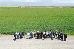
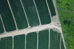
SMART-WADI project: Drone images for farms in Iran
FutureWater travelled to Mashhad, Iran to undertake a series of key activities related to the SMART-WADI project (SMART Water Decisions for Iran) with the main goal of testing drone flights and imagery recovery from agricultural fields. The SMART-WADI project (SMART Water Decisions for Iran), carried out by a consortium of FutureWater, IHE-Delft, and local partner...
1 June 2019
Publication on quantifying services of natural and built infrastructure in the context of climate change
The International Water Management Institute (IWMI) together with FutureWater and other partners have published a report that presents findings from a study conducted to explore the synergies and trade-offs between built (i.e., engineered) and natural (i.e., ecological systems) infrastructure in the Tana River Basin, Kenya. The study considered hydrological, ecological and economic processes in order...
17 May 2019
Use of open source platform for hydrological modelling of data sparse region in Nepal
Flooding has always been a major cause of natural disasters in a mountainous country like Nepal. Among the many natural disasters that affect Nepal, the recurring floods during the monsoon season have catastrophic consequences every year. Nepal’s fragile geological conditions and complex topography combined with frequently occurring extreme rainfall during the monsoon poses risks to...
26 April 2019
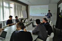
First SPHY-model User Day organized
On 18 March FutureWater organized the first SPHY-model User Day for core developers and users of the SPHY-model. Ten core developers and users from FutureWater, Utrecht University, Wageningen University & Research and CEBAS Spain gathered at the Wageningen International Congress Centre to discuss the upcoming new release of SPHY and the way forward for effective...
1 April 2019
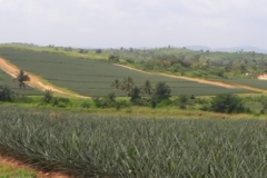
TWIGA Blog: Added value of Flying Sensors: irrigation advice to pineapple farmers
In November 2018, just after the TWIGA days in Kumasi, Ghana, FutureWater, together with partners Hiview and Farmerline, conducted a pilot study using flying sensors (drones) to enhance irrigation water productivity and yields of pineapple farmers. Pineapple is a key economic resource in Ghana, but pineapple yields generally remain low. Yield losses occur due to...
25 March 2019
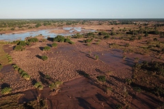
Drones used to aid emergency efforts in Mozambique during the aftermath of Cyclone Idai
On 15 March 2019 Cyclone Idai hit the coast of Mozambique causing devastating damage and severe flooding in the region. The APSAN-Vale project, which is implemented in the Beira Agricultural Growth Corridor of Mozambique, is working closely with rural farming communities in the region affected by Cyclone Idai. The project team are searching ways to...
28 February 2019
TWIGA Blog: Flying Sensors, a catalyst for revolution in farming
How can drone technology support our farming activities? This was the question that Kumasi farmers had when they went into the field for a drone workshop. Under the TWIGA Project, a consulting firm from the Netherlands called HiView was contracted by Future Water to deliver training on Flying Sensors to support Farmers’ Decision Making and Flood...
14 January 2019
TWIGA Blog: Project meeting in Kumasi, Ghana
TWIGA aims at the provision of currently unavailable geo-information on weather, water, and climate for sub-Saharan Africa. This is done by: Enhancing satellite-based geo-data with innovative in-situ sensors and; Developing related information services that address local needs of African stakeholders and the GEOSS community. The TWIGA days organized at the Kwame Nkrumah University of Science...
